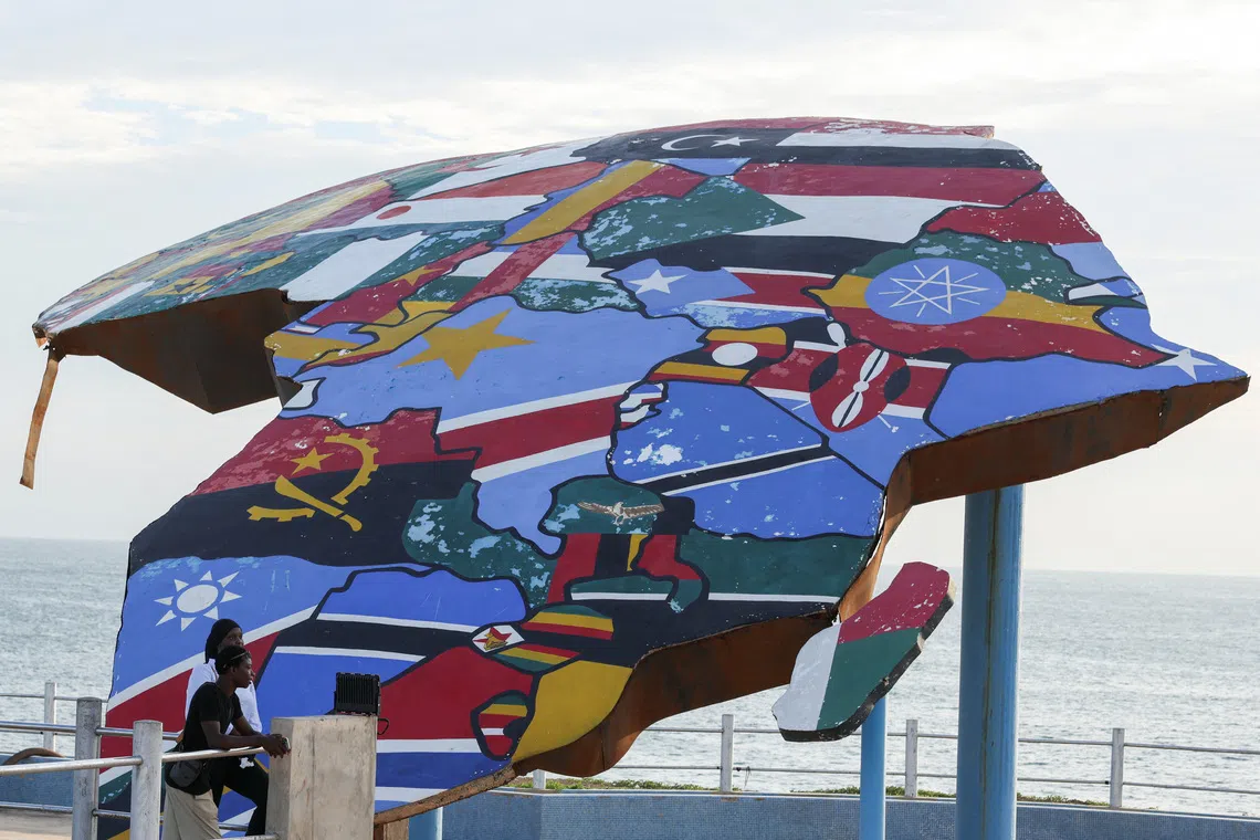
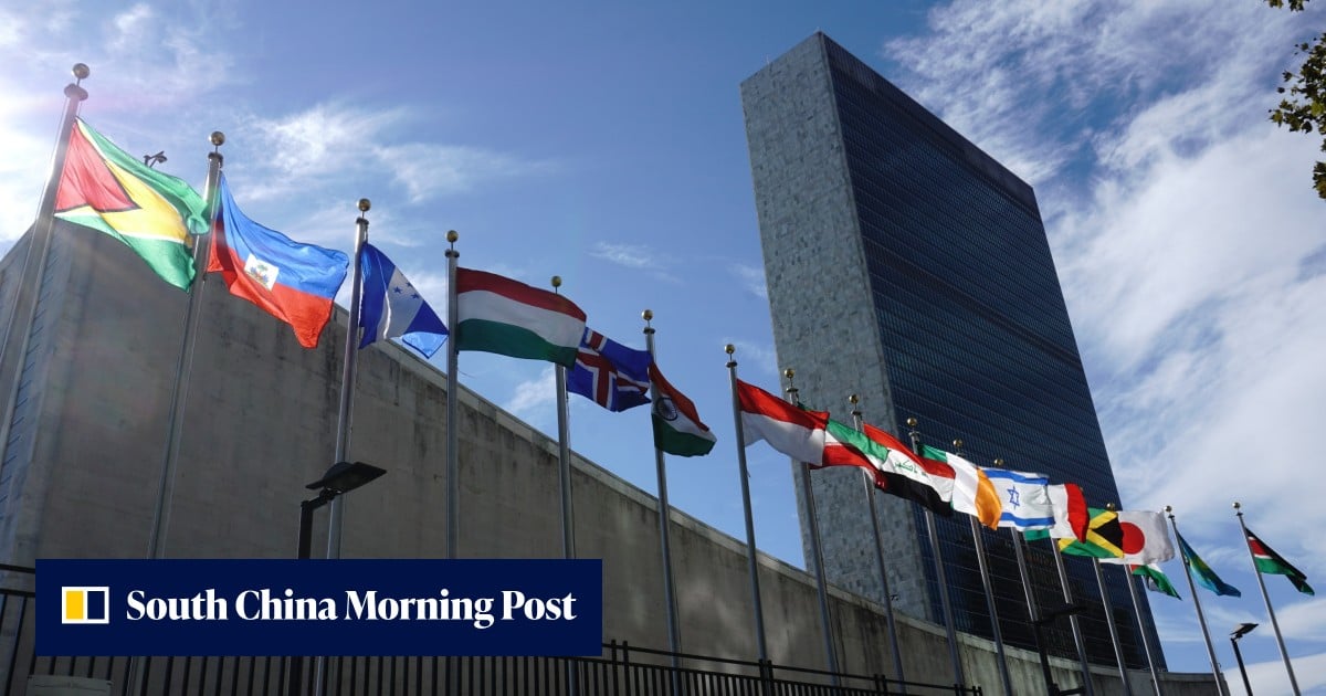
Photo via Al Jazeera

UN votes to adopt new world map that reflects Africa’s true size

Read the original at Al Jazeera ↗
Cite

Everett, M. (2026, September 4). UN votes to adopt new world map that reflects Africa’s true size. Al Jazeera. https://www.aljazeera.com/news/2026/9/4/un-votes-to-adopt-new-world-map-that-reflects-africas-true-size?traffic_source=rss

Dated when The Aporia collected the article, usually within hours of publication. Check the original for its exact date and byline.

Al Jazeera · collected 2026-09-04 · by Mariamne Everett

Quick Summary

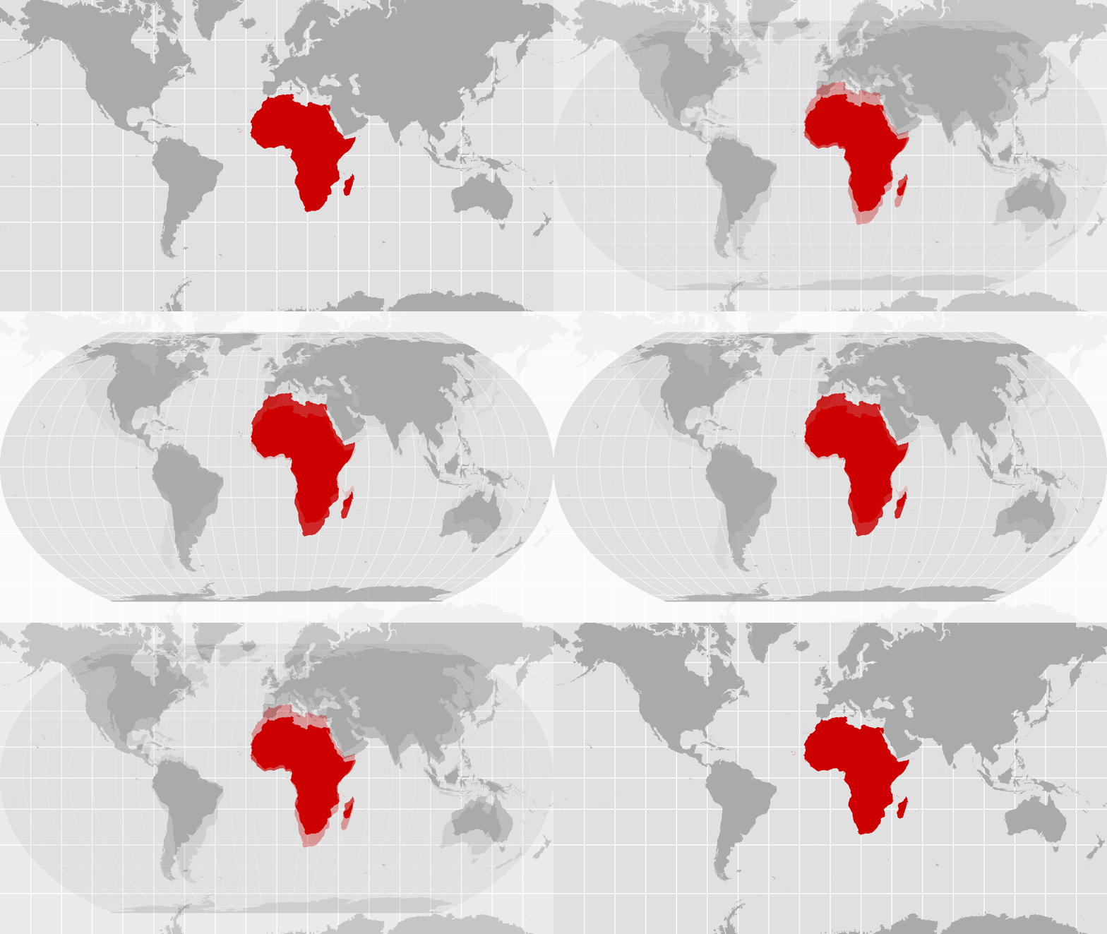
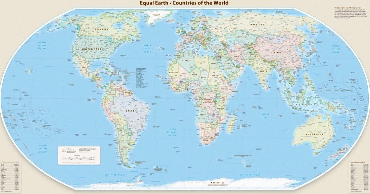
The United Nations General Assembly voted 164-1 on Friday, with six abstentions, to adopt a new world map that accurately reflects countries' true sizes. The resolution, sponsored by African states and the Bahamas, aims to correct a colonial-era injustice that has visually shrunk Africa for 450 years. The proposed "Equal Earth" projection is more accurate in portraying continent sizes, as opposed to the widely-used Mercator map which exaggerates Western nations at the expense of Africa's true size, which is about 14 times larger than Greenland's size. France has announced plans to abandon the Mercator map following the vote.
Written by AI on 2026-09-05, from this article's own text only (the story summary below draws on all the coverage).
See how they differ ↓

AI analysis

Story summary

September 4th, 164 countries, including France and the UK, voted in favor of a resolution at the UN General Assembly to adopt a new world map that more accurately reflects the size of Africa. Only the US voted against it, with six other states abstaining. The new map, known as the Equal Earth cartographic projection, aims to provide a more accurate representation of continental landmasses and reduce distortions caused by the traditional Mercator projection, which has been widely used since the 16th century. According to Foreign Minister Robert Dussey of Togo, "a fair world begins with a fair map," highlighting the importance of cartography in shaping our understanding of the world. The resolution promotes the use of the Equal Earth projection over the Mercator projection, which distorts the relative size of land masses by expanding those nearer the poles, making Greenland appear roughly the same size as Africa, although Africa is about 14 times larger.

Written for “UN Adopts New World Map” on 2026-11-20, grounded in this article and the 24 other(s) covering the same event.

How they differ

15 outlets covered “UN Adopts New World Map”.

What each outlet says

One AI summary per outlet of its latest article on this story, written from that article alone and checked against it. Open the article for the outlet's own words.

Al JazeeraThis outlet4 Sep

The United Nations General Assembly voted 164-1 on Friday, with six abstentions, to adopt a new world map that accurately reflects countries' true sizes. The resolution, sponsored by African states and the Bahamas, aims to correct a colonial-era injustice that has visually shrunk Africa for 450 years. The proposed "Equal Earth" projection is more accurate in portraying continent sizes, as opposed to the widely-used…

UN votes to adopt new world map that reflects Africa’s true size (this article)3 articles from Al Jazeera on this story
The Hindu6 Sep

The United Nations has approved a resolution in support of an alternative map that accurately represents Africa's size, which is often distorted on traditional Mercator projections. The resolution promotes the Equal Earth projection as a more accurate representation. The U.N.'s backing aims to correct centuries-old cartographic inaccuracies. No specific numbers or details about the resolution are provided.

U.N. approves resolution in support of map that shows Africa’s true size →4 articles from The Hindu on this story
The Straits Times4 Sep

The United Nations General Assembly voted to adopt a new world map, known as the Equal Earth cartographic projection, which makes Africa larger while shrinking North America and Europe, with 164 countries in favor and the US voting against it. The resolution aims for a more accurate representation of world geography. Six other states abstained from the vote. The new map is intended to replace the traditional…

While You Were Sleeping: 5 stories you might have missed, Sept 5, 2026 →3 articles from The Straits Times on this story
The Guardian11 Sep

Japan has asked the operator of a new UN world map, known as the Equal Earth cartographic projection, to revise the map because it incorrectly shows the Kuril islands belonging to Russia. The disputed islands are also known in Japan as the Northern Territories and have been at the center of a long-standing territorial dispute between Japan and Russia. 164 UN members voted to adopt the new map on Friday, but it has…

Japan seeks change to new UN world map over Russia 'misconception' →2 articles from The Guardian on this story
BBC5 Sep

The United Nations has adopted a new map called the Equal Earth projection to replace the widely used Mercator map, which distorts the size of continents such as Africa. The Mercator map was created in 1569 by Flemish cartographer Gerardus Mercator for navigation purposes and still influences many modern maps, including Google Maps. The key issue with the Mercator map is that it makes countries near the equator…

What different world maps get right - and what they get wrong →2 articles from BBC on this story
CBS News6 Sep

The United Nations General Assembly on Friday endorsed a new world map called the Equal Earth projection, which accurately represents Africa's larger size compared to Greenland. The resolution, sponsored by Togo and backed by African countries, was passed with 164 votes in favor, including opposition from only the US, and six abstentions. The new map shows continents in their true proportions, with Africa being 14…

UN endorses new map that shows Africa's size more accurately →2 articles from CBS News on this story
Show 9 more outlets
South China Morning Post4 Sep

The UN General Assembly voted 164-1 on Friday, with six abstentions, to adopt a new map called the Equal Earth cartographic projection. The resolution, spearheaded by African countries, makes Africa appear larger while shrinking North America and Europe compared to the traditional Mercator map. This shift is aimed at achieving "a more accurate representation" of continental landmasses, according to the resolution…

UN adopts new map: Africa bigger, North America and Europe smaller →
Dawn4 Sep

The UN General Assembly voted 164-0 (with 6 abstentions) to adopt a new map that makes Africa appear larger and shrinks North America and Europe. The resolution, led by several African countries, aims for a "more accurate representation" of world geography using the Equal Earth cartographic projection. According to cartographers, this new map preserves the relative surface areas of continents and shows their shapes…

UN adopts major map reform to show true scale of continents →
ABC News (AU)4 Sep

The United Nations General Assembly has voted to adopt a new world map, known as the Equal Earth cartographic projection, which makes Africa appear larger and North America smaller compared to the traditional Mercator projection. The motion was carried by 164 countries, with six abstaining and the US voting against it. The resolution aims to provide a more accurate representation of continental landmasses, with the…

Africa bigger, US smaller as UN votes to adopt a new world map →
NPR4 Sep

The United Nations General Assembly has overwhelmingly backed a resolution, known as "Correct the Map", to change how Africa is represented on world maps. The vote was 164 to one, with six countries abstaining, and the only country voting against it was the United States. The resolution encourages the use of equal-area projections, such as Equal Earth, which more accurately show the true relative size of countries…

The U.N. backs a new world map showing Africa in its true relative size →
National Post5 Sep

The UN General Assembly voted 164-0 (with six abstentions) on Friday to adopt a new world map called the Equal Earth cartographic projection, which makes Africa larger and North America and Europe smaller. The resolution aims to provide a more accurate representation of continental landmasses, replacing the traditional Mercator projection that was designed in 1569 for maritime navigation. France co-sponsored the…

UN adopts ‘more accurate’ world map with larger Africa and smaller North America, Europe →
Times of India5 Sep

The United Nations General Assembly has endorsed a new world map called the Equal Earth projection, which accurately reflects Africa's size. 164 countries voted in favor of the resolution, while the US was opposed and six countries abstained. The new map shows Africa as about 14 times larger than Greenland, whereas under the traditional Mercator projection, they appear roughly comparable in size. The resolution…

A bigger Africa & a smaller Europe: What changes in new UN-backed world map →
Sydney Morning Herald5 Sep

The United Nations has voted to adopt a new world map that more accurately reflects countries' true size, shifting away from the 16th-century Mercator map. The resolution, sponsored by African states, passed with 164 votes in favor and 1 against, with some critics arguing that the Mercator map creates a subtle bias towards northern nations. Africa is about 14 times larger than Greenland, which appears roughly the…

Australia and Africa expand, North America and Europe shrink: UN adopts new world map →
Daily Mail6 Sep

The United Nations General Assembly has voted to adopt a new world map, known as the Equal Earth projection, which makes Africa appear larger and corrects what critics call "cartographic colonialism". The resolution, sponsored by Togo and backed by 164 member states, aims to move away from the centuries-old Mercator map. A key aspect of the change is that Africa will appear about 14 times larger than it does on the…

United Nations adopt new world map that shows Africa much bigger and cuts size of UK and US →
The Independent6 Sep

The UN General Assembly has voted in favor of a resolution sponsored by Togo to replace traditional world maps with more accurate representations of nations' sizes. The "Correct the Map" resolution passed with 164 votes in support and was opposed by only the US, with six other countries abstaining. The resolution encourages governments, schools, and companies to use maps that accurately depict Africa's size, which…

UN votes to approve new world map which will show true size of Africa →

Where they agree and split

Agreed

Reported by outlets on both sides of the middle

“Maps shape our understanding of the world,” Togo’s foreign minister Robert Dussey was quoted by the UN as saying ahead of the vote.

9 outlets
Show 3 more

The "Correct the Map" resolution, sponsored by Togo and backed by African Union (AU) members, passed with the support of 164 nations, including France and the UK.

6 outlets

France – which co-sponsored the resolution in support of the new map – announced on Sept 4 that it would abandon the Mercator projection.

5 outlets

“They are therefore never neutral, when they present a distorted image of our planet, they risk perpetuating inaccurate representation that are passed down through generation.”

4 outlets

Disputed

Picked by our model, which is sometimes wrong

  • The US representative criticized the resolution as a reason for the UN losing credibility, whereas other countries supported it.45

Framing

How the first headlines put it

  • South China Morning Post and The Straits Times emphasize that Africa is shown larger while North America and Europe are smaller in the new map.13
Stated as fact12
The headlines (12)

UN votes to adopt new world map that shows Africa’s true scale The Guardian · stated as fact

UN adopts new map: Africa bigger, North America and Europe smaller South China Morning Post · stated as fact

UN adopts new world map showing true scale of continents; only US votes against it The Straits Times · stated as fact

U.N. approves resolution in support of map that shows Africa’s true size The Hindu · stated as fact

UN adopts major map reform to show true scale of continents Dawn · stated as fact

UN votes to adopt new world map to reflect Africa's true size BBC · stated as fact

Africa bigger, US smaller as UN votes to adopt a new world map ABC News (Australia) · stated as fact

The U.N. backs a new world map showing Africa in its true relative size NPR · stated as fact

UN votes to adopt new world map that reflects Africa’s true size Al Jazeera · stated as fact

UN adopts ‘more accurate’ world map with larger Africa and smaller North America, Europe National Post · stated as fact

A bigger Africa & a smaller Europe: What changes in new UN-backed world map Times of India · stated as fact

Australia and Africa expand, North America and Europe shrink: UN adopts new world map Sydney Morning Herald · stated as fact

The full story: what happened, how it changed, and all 25 articles →

Compared with similar articles

This article reads leans left and hedges 0% of its claims. Each row says how that neighbour differs.
BBC News
Hedges 1 of 26 claims Outlet record 65/100
Daily Mail
Hedges 1 of 23 claims Outlet record 69/100
The Straits Times
Hedges 0 of 18 claims Outlet record 64/100
The Hindu
Hedges 0 of 17 claims Outlet record 60/100
The Guardian
Hedges 1 of 31 claims Outlet record 64/100
NPR
Hedges 1 of 29 claims Outlet record 60/100
ABC News (AU)
Leans left Hedges 0 of 21 claims Outlet record 67/100
CBS News
Hedges 0 of 15 claims Outlet record 67/100
The Hindu
Hedges 0 of 2 claims Outlet record 60/100
South China Morning Post
Leans left Hedges 0 of 6 claims Outlet record 62/100

Story

UN Adopts New World Map
World · 25 article(s) covering the same event. Compare every outlet's account →
How this article was measured signals, leaning charts, publisher record, byline, topics and claims

Signals How these are calculated →

Claims extracted
26
sentences that state something as happening or true
Uncertain
0%
0 of 26 hedged ("reportedly", "may", "according to")
Leaning
Leans left
of the writing, not the subject · beta estimate
Publisher signals
60/100
Al Jazeera's corrections and hedging, across everything collected from it. Not a measure of accuracy.
Outlets on this story
25
World
Same framing elsewhere
1
articles that frame the event the way this one does
Analyzed 2026-09-05 · how these are computed

How this is being covered How these are calculated →

Article leaning vs. publisher reliability
Source leaning vs. consistency

Publisher

Al Jazeera · 6159 article(s) · 4 correction(s) detected
Running correction rate · 4 correction(s)

Who wrote this

Mariamne Everett
4 article(s) here · 1 carrying a prediction
The record global heat caused by this year’s powerful “super El Nino” could cause nearly half a million excess deaths worldwide by early next year, according to a report (PDF) published by the global research collaboration, Climate Impact Lab, on Wednesday.
France was rocked by protests on Sunday against proposed legislation that would grant additional protections to law enforcement officials using firearms in the line of duty.
The foreign ministry “will abandon the Mercator projection in favour of map representations tailored to specific uses, more faithful to actual surface areas and in line with the recommendations of cartographers and scientists”, French Foreign Minister Jean-Noel Barrot said in a speech at the Sorbonne University in Paris. “The United States, Russia and China take on a disproportionate visual prominence compared to Africa, Latin America or southeast Asia,” Barrot said, adding that “distortions eventually take root in perceptions” and that “the time has come to correct them.”
Also by Mariamne Everett
Nothing else under this byline is closely related to this article, so these are simply their most recent.

Topics

African China Mercator The United Nations Togo

Subjects

Mercator ORG · 5× Togo GPE · 4× Dussey PERSON · 3× African NORP · 2× China GPE · 2× Reuters ORG · 2× The United States GPE · 2× 3Apple ORG · 1× India GPE · 1× The United Nations ORG · 1×

Narrative

The foreign ministry “will abandon the Mercator projection in favour of map representations tailored to specific uses, more faithful to actual surface areas and in line with the recommendations of cartographers and scientists”, French Foreign Minister Jean-Noel Barrot said in a speech at the Sorbonne University in Paris. “The United States, Russia and China take on a disproportionate visual prominence compared to Africa, Latin America or southeast Asia,” Barrot said, adding that “distortions eventually take root in perceptions” and that “the time has come to correct them.”
framing: assertive · carried by 1 article(s) · first seen 2026-09-05
The foreign ministry “will abandon the Mercator projection in favour of map representations tailored to specific uses, more faithful to actual surface areas and in line with the recommendations of cartographers and scientists”, French Foreign Minister Jean-Noel Barrot said in a speech at the Sorbonne University in Paris. “The United States, Russia and China take on a disproportionate visual prominence compared to Africa, Latin America or southeast Asia,” Barrot said, adding that “distortions eventually take root in perceptions” and that “the time has come to correct them.”
2026-09-05 · Al Jazeera
UN votes to adopt new world map that reflects Africa’s true size · assertive framing

Claims (26 extracted, 0 hedged)

The United Nations has voted to adopt a new world map that more accurately reflects countries’ true sizes, a resolution sponsored by African states to right a centuries-old wrong. asserted
that → vote → wrong
The “Correct the Map” resolution adopted by the UN general assembly on Friday aims to address a colonial-era injustice that has visually shrunk Africa for 450 years, shaping how the continent is perceived in media, education and policy around the world. asserted
continent → correct → world
On a quest to fix the world map - list 2 of 3Apple changes name of Lake Ontario to ‘Lake America’ in maps app - list 3 of 3Google Maps renames Lake Ontario after Trump’s decree on ‘Lake America’ asserted
Maps → fix → America
The resolution, put forward by African Union (AU) member states and the Bahamas, was backed by a vote of 164-1 with six abstentions. asserted
resolution → put → abstentions
Togo led the AU’s campaign to limit use of the widely-used Mercator map. asserted
Togo → lead → map
Developed in the 16th century by Flemish cartographer Gerardus Mercator, the projection distorts the relative size of land masses by expanding those nearer the poles. asserted
projection → develop → poles
For instance, it makes Greenland appear roughly the same size as Africa, even though Africa is about 14 times larger. asserted
Africa → make → Africa
Some critics of the Mercator map believe it remains widely used because it visually exaggerates and centralises Western nations, perpetuating ideas of European superiority. asserted
it → believe → superiority
“A fair world begins with a fair map,” Togo’s Foreign Minister Robert Dussey told the Reuters news agency ahead of Friday’s vote. asserted
Dussey → begin → vote
The resolution promotes the Equal Earth projection, which more accurately portrays the size of the continents. asserted
which → promote → continents
The resolution is not legally binding and it “in no way challenges the use of the Mercator projection for maritime and aerial navigation, for which it remains fully suited,” the Togolese ministry said in a statement. asserted
ministry → challenge → statement
The United States – the only country to vote against the resolution – said it promoted an “ideological agenda” and was a distraction from the “genuine problems of international peace, prosperity or good relations”. asserted
it → vote → peace
Moky Makura, executive director of the advocacy organisation Africa No Filter that’s involved in “Correct the World” map campaign, hailed the vote, saying “now the real work begins”. asserted
work → involve → vote
“We want to see accurate maps in schools, textbooks, newsrooms, businesses and on the digital platforms billions of people use every day,” Makura said in a statement. asserted
Makura → want → statement
“If we got something as basic as Africa’s size wrong for this long, what else about Africa have we simply accepted without questioning? asserted
we → get → Africa
Africa doesn’t need to be made bigger. asserted
Africa → need → ?
It needs to be seen accurately,” she added. asserted
she → need → ?
‘Distortions eventually take root in perceptions’ asserted
Distortions → take → perceptions
Ahead of the vote, France, who co-sponsored the resolution, announced that it planned to abandon the Mercator map. asserted
it → co → map
The foreign ministry “will abandon the Mercator projection in favour of map representations tailored to specific uses, more faithful to actual surface areas and in line with the recommendations of cartographers and scientists”, French Foreign Minister Jean-Noel Barrot said in a speech at the Sorbonne University in Paris. “The United States, Russia and China take on a disproportionate visual prominence compared to Africa, Latin America or southeast Asia,” Barrot said, adding that “distortions eventually take root in perceptions” and that “the time has come to correct them.” asserted
time → abandon → them
The Mercator map remains widely used in classrooms, but Togo hopes to change its school geography materials by the end of the year asserted
Togo → use → year
, Dussey told Reuters. asserted
Dussey → tell → Reuters
Togo will press other governments, schools, international organisations and technology companies to move away from the Mercator map in favour of the Equal Earth one, Dussey said. asserted
Dussey → press → one
Dussey linked the campaign to adopt the map to wider African efforts to confront colonial-era legacies, while saying it was not an attack on Europe or any other civilisation. The Mercator map’s widespread use is a consequence of colonisation, he said. asserted
he → link → colonisation
“The world is changing. asserted
world → change → ?
Africa also is changing.” asserted
Africa → change → ?
Give feedback · no sign-in needed

No sign-in needed for now. Your note is sent without a name, so it cannot be answered.

History Support