Photo via CBS News

First map of U.S. Mason-Dixon Line going up for auction

Read the original at CBS News ↗
Cite

First map of U.S. Mason-Dixon Line going up for auction. (2026, October 29). CBS News. https://www.cbsnews.com/news/first-mason-dixon-line-map-auction-civil-war/

Dated from the outlet's own feed. Check the original for its byline.

CBS News · collected 2026-10-29

Quick Summary

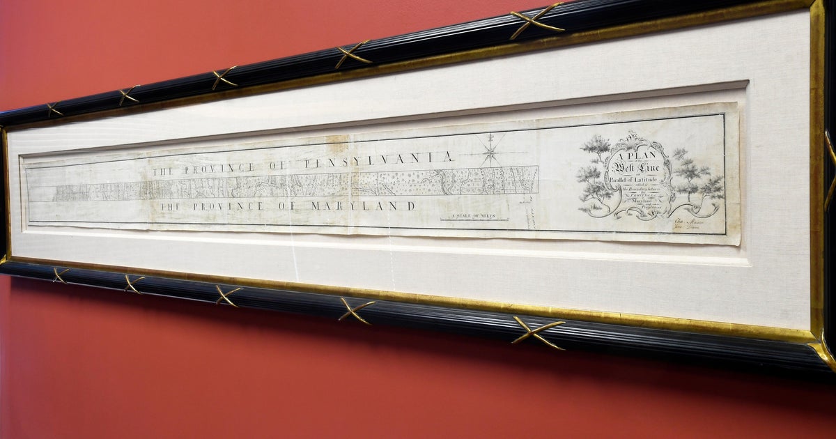
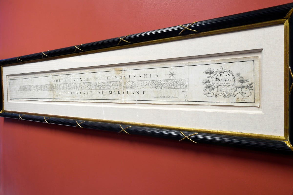
The original hand-drawn map of the Mason-Dixon Line, which marks the border between Maryland and Pennsylvania but later became symbolic of the division between free and slave states in America, is set for auction. Vice President Lauren Brunk from Brunk Auctions estimates the historical document could sell for between $800,000 to $1.2 million during a livestreamed event on Thursday. Drawn by Charles Mason and Jeremiah Dixon between 1767 and 1768, it was initially meant to resolve a territorial dispute but later became pivotal in the Civil War era.
Written by AI on 2026-10-29, from this article's own text only (the story summary below draws on all the coverage).

AI analysis

Story summary

A hand-drawn chart of the Mason-Dixon Line, a boundary dividing free and slave states that later influenced the 1820 Missouri Compromise, is going up for auction on Thursday. The document, which measures 76 inches in length and 6.5 inches in height, is expected to sell between $800,000 and $1.2 million at Brunk Auctions in Asheville, North Carolina. Lauren Brunk, vice president of Brunk Auctions, says the map's historical significance makes it a rare find. The chart was originally drawn by Charles Mason and Jeremiah Dixon between 1767 and 1768 to settle a border dispute between Maryland and Pennsylvania but became symbolic of the divide leading up to the American Civil War. It was previously owned by the family of attorney Benjamin Chew, who represented descendants of William Penn, until it was purchased in 1982 for $360,000 by Malcolm S. Forbes, outbidding the Library of Congress.

Written for “Mason-Dixon Line Map Auction” on 2026-11-04, grounded in this article and the 1 other(s) covering the same event.

Story

📰 Mason-Dixon Line Map Auction
Politics · 2 article(s) covering the same event. See how they differ ↓

Compared with similar articles

This article reads unscored and hedges 5% of its claims. Each row says how that neighbour differs.
The Independent
Hedges 0 of 22 claims Outlet record 59/100
How this article was measured signals, leaning charts, publisher record, byline, topics and claims

Signals How these are calculated →

Claims extracted
20
sentences that state something as happening or true
Uncertain
5%
1 of 20 hedged ("reportedly", "may", "according to")
Leaning
not political
takes no side on a contested political question
Publisher signals
65/100
CBS News's corrections and hedging, across everything collected from it. Not a measure of accuracy.
Outlets on this story
2
Politics
Same framing elsewhere
1
articles that frame the event the way this one does
Analyzed 2026-10-29 · how these are computed

How this is being covered How these are calculated →

Article leaning vs. publisher reliability
Source leaning vs. consistency

Publisher

CBS News · 4566 article(s) · 7 correction(s) detected
Running correction rate · 7 correction(s)

Who wrote this

No reporter is named on this article.

Topics

American Brunk Northern Pennsylvania Southern

Subjects

Brunk PERSON · 6× American NORP · 2× Charles Mason PERSON · 2× Jeremiah Dixon PERSON · 2× Northern NORP · 2× Pennsylvania GPE · 2× Southern NORP · 2× the Library of Congress ORG · 2× Japanese NORP · 1× Lauren Brunk PERSON · 1×

Narrative

But when it was used in the 1820 Missouri Compromise to establish the limits of human bondage in the still adolescent United States, it became synonymous with the fundamental divisions that exploded into Civil War four decades later.
framing: assertive · carried by 1 article(s) · first seen 2026-10-29
🔮 Remounted on backing made of Japanese rice paper, the document will go on sale Thursday in a livestreamed event.
2026-10-29 · CBS News
First map of U.S. Mason-Dixon Line going up for auction · assertive framing

Claims (20 extracted, 1 hedged)

The hand-drawn chart of the Mason-Dixon Line that eventually divided the free from the slave states is going up for auction. asserted
that → draw → auction
Remounted on backing made of Japanese rice paper, the document will go on sale Thursday in a livestreamed event. asserted
document → remount → event
"It's not that often that you can really get this close to something that is so historically important," said Lauren Brunk, vice president of Brunk Auctions in Asheville, North Carolina. asserted
Brunk → get → Asheville
"And it was awe-inspiring, really." asserted
it → inspire → ?
Brunk estimates it could fetch anywhere from $800,000 to $1.2 million for the anonymous seller. uncertain
it → estimate → seller
"Drawn between 1767 and 1768 by Charles Mason ... and Jeremiah Dixon ... the Mason-Dixon Line is the symbolic boundary between Northern and Southern states," Brunk says on its website. asserted
Brunk → draw → website
The survey by Charles Mason and Jeremiah Dixon was originally meant to settle a border dispute between the then-colonies of Maryland and Pennsylvania. asserted
survey → mean → Maryland
But when it was used in the 1820 Missouri Compromise to establish the limits of human bondage in the still adolescent United States, it became synonymous with the fundamental divisions that exploded into Civil War four decades later. asserted
that → use → War
"The Mason-Dixon Line that most Americans know is this dividing line between the Northern free states and the Southern slaveholding states," Brunk said. asserted
Brunk → know → states
"But the line was not drawn for that reason." asserted
line → draw → reason
A popular theory is that the term "Dixie" comes from Dixon, though the true origin is disputed. asserted
origin → come → Dixon
Soon after it was drawn, the linen-backed strip of paper -- 76 inches long and 6.5 inches tall -- was given to the family of attorney Benjamin Chew, who represented the descendants of Pennsylvania founder William Penn. asserted
who → draw → Penn
The map remained in the family's hands until 1982, when late publisher Malcolm S. Forbes outbid the Library of Congress and bought it for $360,000, Brunk said. asserted
Brunk → remain → 360,000
At the time, it was said to have been the highest price ever paid at auction for an American map. asserted
it → say → map
The map changed hands again in 2002. asserted
map → change → 2002
A vertical section showing the Delaware-Maryland border is housed at Princeton University. asserted
section → show → University
Brunk reached out to officials at the Library of Congress to see if they wanted to bid on it again. asserted
they → reach → it
"I wanted them to be aware that this was coming back to the market," she said. asserted
she → want → market
"And they said, at this point, budgets being what they are, they were just not in a position to buy it. asserted
they → say → it
" But if some patriot out there wants to purchase it on the library's behalf, Brunk said, "they'd be happy to have it." asserted
they → want → it
💬Give feedback
🕘History 🎫Support