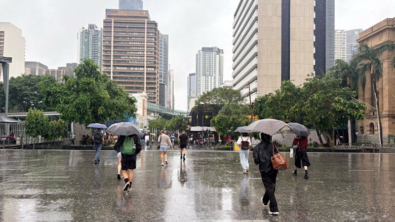
Photo via ABC News (AU)

Giant hail, heavy rain and damaging winds possible for south-east Qld

Read the original at ABC News (AU) ↗
Cite

Allison, C. (2026, November 15). Giant hail, heavy rain and damaging winds possible for south-east Qld. ABC News (AU). https://www.abc.net.au/news/2026-11-16/severe-storms-south-east-qld-heatwave-north/107387434

Dated from the outlet's own feed. Check the original for its byline.

ABC News (AU) · collected 2026-11-15 · by Charmayne Allison

Quick Summary

Severe thunderstorms with potential for giant hail, heavy rain, and destructive winds are expected in south-east Queensland from midday today, peaking between 2pm and 5pm, according to the Bureau of Meteorology. Areas at risk include regions south of Hervey Bay to the Gold Coast and west towards Toowoomba. Meanwhile, a severe heatwave warning remains in place for Cape York Peninsula and other northern districts, with Weipa experiencing 41 consecutive days of temperatures above 36 degrees Celsius.
Written by AI on 2026-11-15, from this article's own text only (the story summary below draws on all the coverage).
See how they differ ↓

AI analysis

Story summary

As of Monday, severe thunderstorms are forecast to hit south-east Queensland, potentially bringing giant hail, heavy rain, and destructive winds. The Bureau of Meteorology warns that the storms could start around midday and peak between 2pm and 5pm, affecting areas from Hervey Bay to the Gold Coast and west to Toowoomba. Meteorologist Robert Urbaniak stated that hail larger than 5 centimeters and winds exceeding 125 kilometers per hour are possible. The severe heatwave warning remains in place for the Cape York Peninsula, North Tropical Coast, and Tablelands districts. Thunderstorm activity was already observed early Monday morning with some areas receiving between 10 and 30 millimeters of rain. The Bureau of Meteorology advises residents to prepare for a significant change in weather conditions from midday onward.

Written for “Thunderstorms Hit South-east Qld” on 2026-11-17, grounded in this article and the 1 other(s) covering the same event.

How they differ

2 outlets covered “Thunderstorms Hit South-east Qld”.

What each outlet says

One AI summary per outlet of its latest article on this story, written from that article alone and checked against it. Open the article for the outlet's own words.

ABC News (AU)This outlet15 Nov

Severe thunderstorms with potential for giant hail, heavy rain, and destructive winds are expected in south-east Queensland from midday today, peaking between 2pm and 5pm, according to the Bureau of Meteorology. Areas at risk include regions south of Hervey Bay to the Gold Coast and west towards Toowoomba. Meanwhile, a severe heatwave warning remains in place for Cape York Peninsula and other northern districts…

Giant hail, heavy rain and damaging winds possible for south-east Qld (this article)
Sydney Morning Herald15 Nov

South-east Queensland faces potential severe weather starting midday Monday, with the Bureau of Meteorology warning of dangerous storms bringing giant hail and destructive winds. The region experienced early morning thunderstorms and up to 30 millimeters of rain. Meteorologist Robert Urbaniak predicts the storms will intensify, with hail larger than five centimeters and winds exceeding 125 km/h, moving from west to…

Thunderstorms and giant hail on the cards for south-east →

Compared with similar articles

This article reads unscored and hedges 14% of its claims. Each row says how that neighbour differs.
The Sydney Morning Herald
Hedges 2 of 11 claims Outlet record 61/100
ABC News (AU)
Hedges 1 of 12 claims Outlet record 67/100
“While both articles describe severe thunderstorms in south-east Queensland, they refer to different time periods: Article A predicts the storm for the day of its publication (2026-11-15), while Article B reports on the actual occurrence of the storm the following day (2026-11-16).”

Story

Thunderstorms Hit South-east Qld
Environment · 2 article(s) covering the same event. See how they differ ↑
How this article was measured signals, leaning charts, publisher record, byline, topics and claims

Signals How these are calculated →

Claims extracted
21
sentences that state something as happening or true
Uncertain
14%
3 of 21 hedged ("reportedly", "may", "according to")
Leaning
not political
takes no side on a contested political question
Publisher signals
67/100
ABC News (AU)'s corrections and hedging, across everything collected from it. Not a measure of accuracy.
Outlets on this story
2
Environment
Same framing elsewhere
1
articles that frame the event the way this one does
Analyzed 2026-11-15 · how these are computed

How this is being covered How these are calculated →

Article leaning vs. publisher reliability
Source leaning vs. consistency

Publisher

ABC News (AU) · 5888 article(s) · 11 correction(s) detected
Running correction rate · 11 correction(s)

Who wrote this

Charmayne Allison
4 article(s) here · 1 carrying a prediction
The Bureau of Meteorology says severe thunderstorm risks are expected to shift north from Tuesday.
In short: Property prices have slumped 4 per cent in regional Queensland since a peak in May.
The court heard between May 2017 and April 2021, the former carpenter turned property developer dishonestly used $2,294,239 of investor funds.
He will be released on parole in November this year.
Also by Charmayne Allison
Nothing else under this byline is closely related to this article, so these are simply their most recent.

Topics

Gatton Queensland The Bureau of Meteorology Toowoomba Weipa

Subjects

Queensland GPE · 5× Urbaniak PERSON · 4× Gatton GPE · 2× The Bureau of Meteorology ORG · 2× Toowoomba GPE · 2× Maranoa GPE · 1× Qld GPE · 1× Robert Urbaniak PERSON · 1× Warrego GPE · 1× Weipa GPE · 1×

Narrative

On Sunday, severe storms affected several different regions, including South East Queensland, the Darling Downs, Maranoa and Warrego, Central Highlands and all the way in the state's North West.
framing: assertive · carried by 1 article(s) · first seen 2026-11-15
The Bureau of Meteorology says severe thunderstorm risks are expected to shift north from Tuesday.
2026-11-15 · ABC News (AU)
Giant hail, heavy rain and damaging winds possible for south-east Qld · assertive framing

Claims (21 extracted, 3 hedged)

A severe heatwave warning remains in place for the Cape York Peninsula, North Tropical Coast and Tablelands districts. asserted
warning → remain → districts
The Bureau of Meteorology says severe thunderstorm risks are expected to shift north from Tuesday. asserted
risks → say → Tuesday
Severe thunderstorms could bring giant hail, heavy rain and destructive winds to south-east Queensland from midday today, the Bureau of Meteorology warns. uncertain
Bureau → bring → Meteorology
Meteorologist Robert Urbaniak said areas south of Hervey Bay down to the Gold Coast and west towards Toowoomba could be in the firing line. uncertain
areas → say → line
"There is a chance for giant hail, which is bigger than 5 centimetres, and intense rainfall and destructive winds greater than 125 kilometres an hour," he said. asserted
he → be → kilometres
The bureau said the severe storms were expected to hit from midday and peak between 2pm and 5pm. asserted
storms → say → pm
"Regular thunderstorms are possible most other places other than the far south-west," Mr Urbaniak said. asserted
Urbaniak → say → west
Severe heatwave warning continues A severe heatwave warning remains in place for the Cape York Peninsula, North Tropical Coast and Tablelands districts. asserted
warning → continue → districts
Weipa has recorded its longest stretch of days with temperatures above 36 degrees Celsius, with 41 days as of Sunday. asserted
Weipa → record → Sunday
Mr Urbaniak said this was expected to continue into the coming weekend. asserted
this → say → weekend
"By the end of the week it might have recorded 48 days with consecutive daily temperatures above 36 degrees, which is absolutely crazy," he said. uncertain
he → record → degrees
Meanwhile in southern parts of the state, temperatures are expected to drop midweek. asserted
temperatures → expect → state
"Temperatures will go down to sort of the mid-20s by late this week," Mr Urbaniak said. asserted
Urbaniak → go → week
The latest forecasts come after a weekend of wet and stormy weather across parts of the state. asserted
forecasts → come → state
Severe storms hit late on Friday and into Saturday morning, particularly around the eastern Darling Downs and near Gatton. asserted
storms → hit → Gatton
Areas south-west of Toowoomba were drenched by up to 80 millimetres in two hours, with up to 60mm in half an hour near Gatton. asserted
Areas → drench → Gatton
On Sunday, severe storms affected several different regions, including South East Queensland, the Darling Downs, Maranoa and Warrego, Central Highlands and all the way in the state's North West. asserted
storms → affect → West
Storms expected to clear SEQ from Tuesday Mr Urbaniak said severe thunderstorm risks were expected to clear south-east Queensland from Tuesday. asserted
risks → expect → Tuesday
The focus is then expected to shift to the Capricornia Coast and Northern Queensland on Tuesday and Wednesday. asserted
focus → expect → Tuesday
A new trough is forecast to sweep into far-western Queensland on Thursday and Friday. asserted
trough → forecast → Thursday
The bureau said this would bring widespread showers and thunderstorms from the Gulf Country through to Charleville, Augathella and Cunnamulla. asserted
this → say → Charleville

Give feedback · no sign-in needed

No sign-in needed for now. Your note is sent without a name, so it cannot be answered.

History Support