Photo via Toronto Star

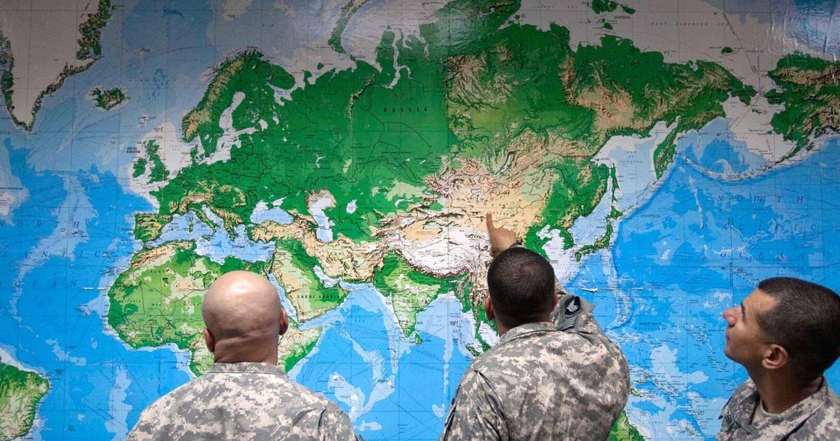
This truth emerges as political situations change fast: Maps show us our world, but not neutrally

Read the original at Toronto Star ↗
Cite

Hajela, D. (2026, September 20). This truth emerges as political situations change fast: Maps show us our world, but not neutrally. Toronto Star. https://www.thestar.com/news/world/this-truth-emerges-as-political-situations-change-fast-maps-show-us-our-world-but-not-neutrally/article_2340aa32-0099-5e43-89cf-dfaf34ce6ca5.html

Dated when The Aporia collected the article, usually within hours of publication. Check the original for its exact date and byline.

Toronto Star · collected 2026-09-20 · by Deepti Hajela

Quick Summary

Maps are crucial for understanding our world but come with inherent biases due to choices about scale, borders, and terminology. Recently, a United Nations General Assembly vote supported a new map that more accurately depicts Africa as larger relative to other continents. The resolution was passed by 164 countries, with the U.S. being one of two nations voting against it. Political tensions influence these decisions; for instance, President Trump issued orders renaming geographical features like Lake Ontario and the Gulf of Mexico. These changes highlight how maps not only represent geography but also shape political perspectives and relations.
Written by AI on 2026-09-20, from this article's own text only (the story summary below draws on all the coverage).

AI analysis

Story summary

Maps are often seen as neutral representations of reality, but they can significantly shape political perspectives and have real-world consequences. At the United Nations General Assembly in September, a vote endorsed a new map that more accurately portrays Africa's size relative to other continents. This change was supported by 164 countries, with six abstaining and the United States voting against it. The decision highlights how maps can influence political perceptions and relationships between nations. Assistant Professor Alex Moulton from Hunter College argues that maps structure our politics in ways that have tangible effects on the world.

Written for “Mapping Bias Controversy” on 2026-11-03, grounded in this article and the 0 other(s) covering the same event.

Story

📰 Mapping Bias Controversy
Politics · 1 article(s) covering the same event.

Compared with similar articles

Nothing to compare against. No article is close enough to this one for the pipeline to have linked or judged the pair.
How this article was measured signals, leaning charts, publisher record, byline, topics and claims

Signals How these are calculated →

Claims extracted
35
sentences that state something as happening or true
Uncertain
3%
1 of 35 hedged ("reportedly", "may", "according to")
Leaning
Leans left
of the writing, not the subject · beta estimate
Publisher signals
64/100
Toronto Star's corrections and hedging, across everything collected from it. Not a measure of accuracy.
Outlets on this story
1
Politics
Same framing elsewhere
1
articles that frame the event the way this one does
Analyzed 2026-09-20 · how these are computed

How this is being covered How these are calculated →

Article leaning vs. publisher reliability
Source leaning vs. consistency

Publisher

Toronto Star · 11143 article(s) · 28 correction(s) detected
Running correction rate · 28 correction(s)
2026-10-26
Correction
2026-10-24
Correction
2026-10-07
Correction
2026-09-24
Correction

Who wrote this

Deepti Hajela
7 article(s) here · 1 carrying a prediction
🔮 It was something most people have likely done at one time or another: complain to others about feeling judged or dismissed during an interaction, maybe even take to social media to post about it.
🔮 They hope the flood of “I am Jane Doe” posts will confuse online algorithms.
🔮 Where would we be without them? And how would we even know? They can anchor us in a place or help us get somewhere else.
🔮 NEW YORK (AP) — When the planes crashed and the buildings fell on that sunny September morning 25 years ago, the shock waves of dismay and grief went far past downtown New York City, rural western Pennsylvania and just outside Washington, D.C.
Also by Deepti Hajela
Nothing else under this byline is closely related to this article, so these are simply their most recent.
All 7 articles by Deepti Hajela →

Topics

Canada General Assembly NEW YORK the United Nations the United States

Subjects

Canada GPE · 2× Apple ORG · 1× Donald Trump PERSON · 1× General Assembly ORG · 1× Google ORG · 1× MapQuest ORG · 1× NEW YORK GPE · 1× U.S. GPE · 1× the United Nations ORG · 1× the United States GPE · 1×

Narrative

“To the extent that maps come to shape the way that we think about different places and people who inhabit them, maps structure our politics in ways that then have consequences,” said Alex Moulton, assistant professor in the geography and environmental science department at Hunter College.
framing: assertive · carried by 1 article(s) · first seen 2026-09-20
🔮 Where would we be without them? And how would we even know? They can anchor us in a place or help us get somewhere else.

Claims (35 extracted, 1 hedged)

Where would we be without them? And how would we even know? They can anchor us in a place or help us get somewhere else. asserted
us → know → place
They can show us global political realities via the drawing of contested country borders. asserted
They → show → borders
We take it as truth that not only does X mark the spot, it shows us the size of the spot, what the spot’s name is and how the spot compares with other spots. asserted
spot → take → spots
But while the physical geography of our world can be set in stone, the reality is that maps are not. asserted
maps → set → stone
There are choices involved in everything from which countries are centered to their size relative to each other and what the objects on the map are called. asserted
objects → be → map
The choices create the perspective and they affect the way we assume the world looks. asserted
world → create → way
That was evident this month at the United Nations when a General Assembly vote endorsed a map with a different way of looking at the world than has more commonly been used. asserted
vote → endorse → world
This map showed Africa more accurately and larger. asserted
map → show → Africa
The vote was 164 countries in favor of the change, six abstaining and one — the United States — against. asserted
one → abstain → change
In August, President Donald Trump signed an order directing the federal government to rename Lake Ontario to “Lake America” as a trade war with Canada continues. asserted
war → sign → Canada
In January 2025, he signed an order renaming the Gulf of Mexico to the “Gulf of America.” asserted
he → sign → America
Some tech companies such as Google and Apple followed along with the changes for U.S. users. asserted
companies → follow → users
MapQuest did not, nor asserted
MapQuest → do → ?
“To the extent that maps come to shape the way that we think about different places and people who inhabit them, maps structure our politics in ways that then have consequences,” said Alex Moulton, assistant professor in the geography and environmental science department at Hunter College. asserted
Moulton → come → College
Distortions are inevitable There is never going to be a flat map that is 100% accurate to the physical geography it is showing. asserted
it → be → geography
That is because taking something in 3D, like Earth, and drawing it in flat 2D as a map is always going to result in distortions. asserted
taking → take → distortions
What mapmakers do is decide which distortions they are going to allow, depending on a map’s purpose. asserted
they → decide → purpose
Those decisions can be invisible to the general public, who see the map as absolute reality and a foundation for how they think of the world. asserted
they → see → world
It was created in Europe as a navigational tool, with the longitudes and latitudes structured in such a way that ships could get from one place to another. uncertain
ships → create → another
In order to do that, though, the size of the world’s land masses had to be altered. asserted
size → have → masses
Those nearer the poles, like Greenland, appear bigger. asserted
Those → appear → Greenland
Those nearer the equator, like the countries of Africa, were made smaller. asserted
Those → make → Africa
It was that distortion that pushed the efforts leading to the U.N.‘s vote in support of the Equal Earth projection map, which supporters say is more accurate in terms of size. asserted
supporters → push → size
Why does that matter? asserted
that → matter → ?
Because the way we see things can impact how we relate to them, with political and economic implications, said Nerve Macaspac, a political geographer and assistant professor at Queens College. asserted
Macaspac → see → College
“If you see Africa as a smaller land mass, there’s a political implication to that. asserted
you → see → that
If we see it larger or it’s in true size, then there is economic and political implications to it,” Macaspac said. asserted
Macaspac → see → it
“What’s being foregrounded and what’s been hidden or obscured or neglected or ignored or reduced?” Maps as moments What is included on maps can also make them snapshots of a particular period. asserted
them → foreground → period
What was considered the “United States” would look different depending on what point in its 250-year history was being put to paper. asserted
point → consider → paper
Maps “really are a time capsule of how that cartographer saw the world,” said Tony Rodono, owner of The Map Shop, based in Charlotte, North Carolina. asserted
Rodono → see → Charlotte
“That was their understanding of world at the particular time with everything that surrounding that person’s human experience.” asserted
That → surround → experience
Trump’s orders to change the names of bodies of water are examples of this as well, as his order renaming the mountain in Alaska that had been called Denali during the Obama administration back to its previous moniker of Mount McKinley. asserted
that → change → McKinley
It’s the tallest peak in North America. asserted
It → ’ → America
“Map-making is world-making,” Moulton said. asserted
Moulton → say → ?
“It is apprehending our world as we observe it and then putting that down as the truth of those things and that is an inherently political practice.” asserted
that → apprehend → things
💬Give feedback
🕘History 🎫Support