Photo via CBS News

UN endorses new map that shows Africa's size more accurately

Read the original at CBS News ↗
Cite

UN endorses new map that shows Africa's size more accurately. (2026, September 6). CBS News. https://www.cbsnews.com/news/united-nations-map-vote-change-africa-size/

Dated when The Aporia collected the article, usually within hours of publication. Check the original for its exact date and byline.

CBS News · collected 2026-09-06

Quick Summary

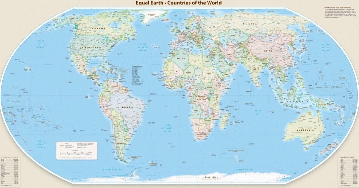
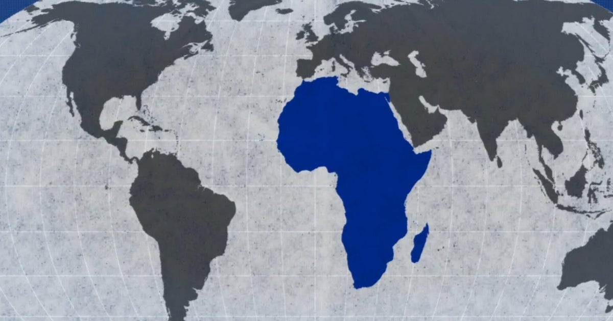
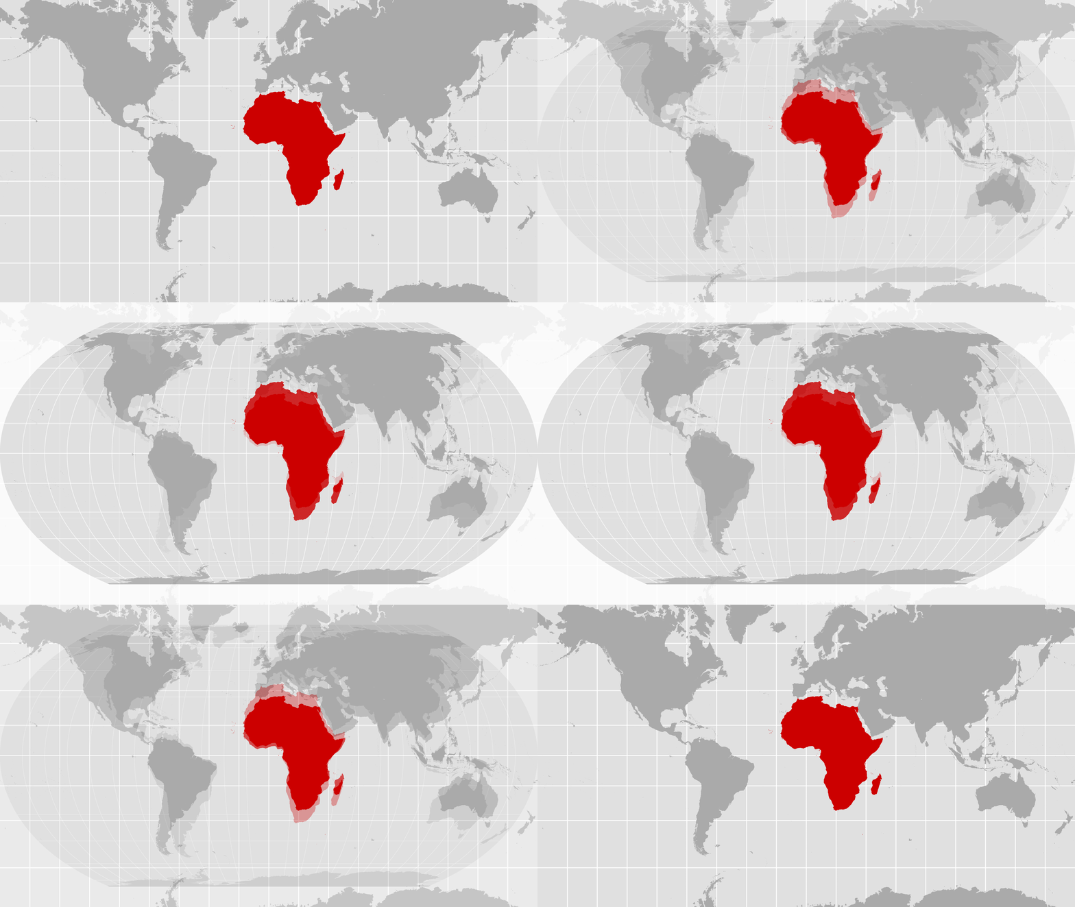
The United Nations General Assembly on Friday endorsed a new world map called the Equal Earth projection, which accurately represents Africa's larger size compared to Greenland. The resolution, sponsored by Togo and backed by African countries, was passed with 164 votes in favor, including opposition from only the US, and six abstentions. The new map shows continents in their true proportions, with Africa being 14 times larger than Greenland, a significant change from the traditional Mercator map that has been widely used since the 16th century. The resolution encourages governments and institutions to use the Equal Earth projection, but does not impose its adoption.
Written by AI on 2026-09-06, from this article's own text only (the story summary below draws on all the coverage).

AI analysis

Story summary

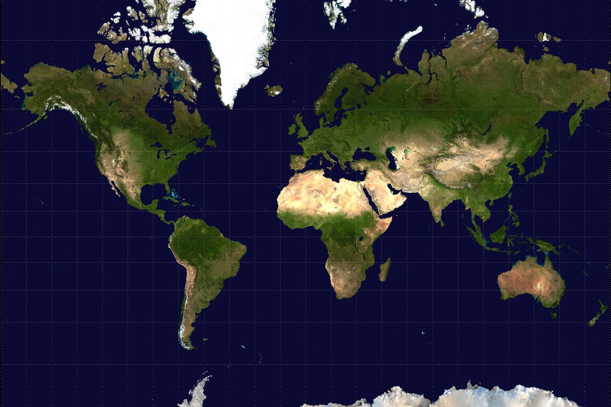
September 4th, 164 countries, including France and the UK, voted in favor of a resolution at the UN General Assembly to adopt a new world map that more accurately reflects the size of Africa. Only the US voted against it, with six other states abstaining. The new map, known as the Equal Earth cartographic projection, aims to provide a more accurate representation of continental landmasses and reduce distortions caused by the traditional Mercator projection, which has been widely used since the 16th century. According to Foreign Minister Robert Dussey of Togo, "a fair world begins with a fair map," highlighting the importance of cartography in shaping our understanding of the world. The resolution promotes the use of the Equal Earth projection over the Mercator projection, which distorts the relative size of land masses by expanding those nearer the poles, making Greenland appear roughly the same size as Africa, although Africa is about 14 times larger.
Written for “UN Adopts New World Map” on 2026-10-30, grounded in this article and the 24 other(s) covering the same event.

Story

📰 UN Adopts New World Map
World · 25 article(s) covering the same event. Compare every outlet's account →

Compared with similar articles

This article reads unscored and hedges 0% of its claims. Each row says how that neighbour differs.
NPR
Hedges 1 of 29 claims Outlet record 60/100
BBC News
Hedges 1 of 26 claims Outlet record 69/100
CBS News
Hedges 0 of 3 claims Outlet record 66/100
The Independent
Hedges 2 of 25 claims Outlet record 59/100
The Guardian
Hedges 1 of 31 claims Outlet record 66/100
The Hindu
Hedges 0 of 2 claims Outlet record 60/100
The Hindu
Hedges 0 of 17 claims Outlet record 60/100
The Straits Times
Hedges 0 of 18 claims Outlet record 66/100
ABC News (AU)
⚖️ Leans left Hedges 0 of 21 claims Outlet record 68/100
Al Jazeera
⚖️ Leans left Hedges 0 of 26 claims Outlet record 60/100
How this article was measured signals, leaning charts, publisher record, byline, topics and claims

Signals How these are calculated →

Claims extracted
15
sentences that state something as happening or true
Uncertain
0%
0 of 15 hedged ("reportedly", "may", "according to")
Leaning
not political
takes no side on a contested political question
Publisher signals
66/100
CBS News's corrections and hedging, across everything collected from it. Not a measure of accuracy.
Outlets on this story
25
World
Same framing elsewhere
1
articles that frame the event the way this one does
Analyzed 2026-09-06 · how these are computed

How this is being covered How these are calculated →

Article leaning vs. publisher reliability
Source leaning vs. consistency

Publisher

CBS News · 4207 article(s) · 6 correction(s) detected
Running correction rate · 6 correction(s)

Who wrote this

No reporter is named on this article.

Topics

African Mercator The United Nations General Assembly Togo the African Union

Subjects

Togo GPE · 2× African NORP · 1× Estonia GPE · 1× Georgia GPE · 1× Lithuania GPE · 1× Moldova GPE · 1× Serbia GPE · 1× The United Nations General Assembly ORG · 1× U.S. GPE · 1× the African Union ORG · 1×

Narrative

The Mercator map was designed by Flemish cartographer Gerardus Mercator to help European navigators at sea, but advocates say it distorted landmasses by enlarging regions near the poles such as North America and Greenland while shrinking Africa and South America.
framing: assertive · carried by 1 article(s) · first seen 2026-09-06
2026-09-06 · CBS News
UN endorses new map that shows Africa's size more accurately · assertive framing

Claims (15 extracted, 0 hedged)

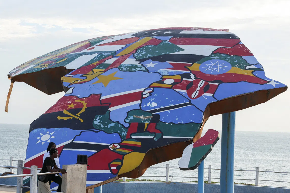
The United Nations General Assembly on Friday endorsed a new world map that represents Africa more accurately in its larger size, a culmination of a recent campaign led by African countries and advocacy groups. asserted
that → endorse → countries
Friday's resolution, which was sponsored by Togo and backed by members of the African Union, was passed with 164 member states voting in favor. asserted
states → sponsor → favor
Only the U.S. voted against it while six other countries - Serbia, Estonia, Georgia, Lithuania, Moldova and Ukraine - abstained. asserted
countries → vote → it
The vote encourages governments and institutions around the world to replace the traditional Mercator map, commonly used since the 16th Century, with the Equal Earth projection that advocates and geographers say shows locations more accurately. asserted
advocates → encourage → locations
The Mercator projection shows Greenland and Africa as appearing to be about the same size whereas in the Equal Earth projection that shows continents in their true proportions, Africa is 14 times larger than Greenland. asserted
Africa → show → Greenland
Friday's resolution does not ban the Mercator projection or impose a replacement, but only encourages the use of the Equal Earth projection, the U.N. said in its report. asserted
U.N. → ban → report
"Maps shape our understanding of the world," the global body quoted Togo's Foreign Minister Robert Dussey as saying before the vote. asserted
body → shape → vote
"They guide education, nourish the imagination, and influence collective perceptions." asserted
They → guide → perceptions
Africa No Filter, one of the lead campaigners for the adoption of the new map, hailed the resolution, adding: "We want to see accurate maps in schools, textbooks, newsrooms, businesses and on the digital platforms billions of people use every day." asserted
billions → hail → people
Several countries hailed the adoption and urged the adoption of the Equal Earth map. asserted
countries → hail → map
"Changing the map obviously doesn't change the world. asserted
Changing → change → world
But correcting a representation that distorts it is already an act of truth," French Foreign Minister Jean-Noël Barrot said on X after the vote. asserted
Barrot → correct → vote
The Mercator map was designed by Flemish cartographer Gerardus Mercator to help European navigators at sea, but advocates say it distorted landmasses by enlarging regions near the poles such as North America and Greenland while shrinking Africa and South America. asserted
it → design → Africa
The 2018 Equal Earth projection, on the other hand, follows the Earth's curvature and shows continents in their true proportions. asserted
projection → follow → proportions
Geographers say the traditional map is only useful for navigation. asserted
map → say → navigation
💬Give feedback
🕘History 🎫Support