 The Aporia

Burke, J., & Staunton, E. (2026, October 1). New Google Maps images reveal massive scale of devastation in Gaza. The Guardian. https://www.theguardian.com/world/2026/oct/01/new-google-maps-images-reveal-massive-scale-of-devastation-in-gaza
Burke, Jason, and Eithne Staunton. “New Google Maps images reveal massive scale of devastation in Gaza.” The Guardian, 1 Oct. 2026, https://www.theguardian.com/world/2026/oct/01/new-google-maps-images-reveal-massive-scale-of-devastation-in-gaza.
Burke, Jason, and Eithne Staunton. “New Google Maps images reveal massive scale of devastation in Gaza.” The Guardian, October 1, 2026. https://www.theguardian.com/world/2026/oct/01/new-google-maps-images-reveal-massive-scale-of-devastation-in-gaza.
Dated when The Aporia collected the article, usually within hours of publication. Check the original for its exact date and byline.
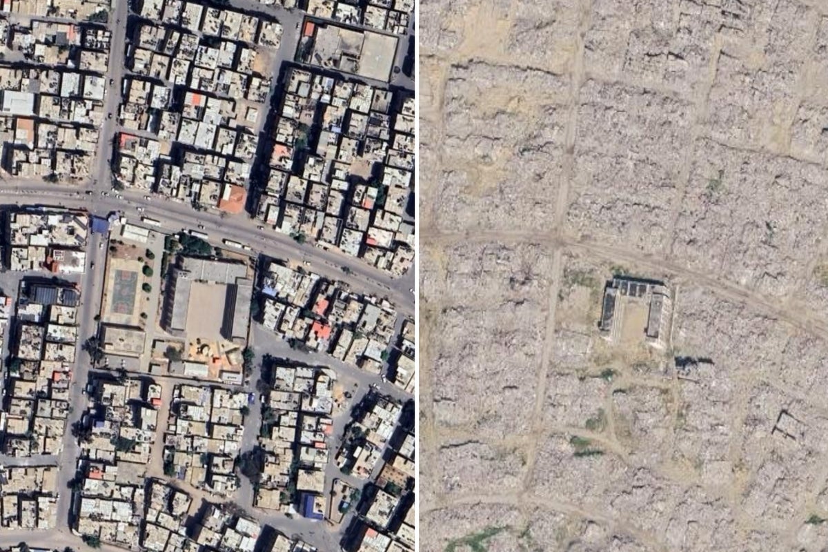
Google Maps has updated its satellite imagery, revealing extensive destruction in Gaza following years of conflict. Images taken in June highlight further damage to homes, businesses, places of worship, and infrastructure since a ceasefire was established almost 12 months ago. The pictures show tented camps lining the shoreline near Gaza's damaged main port, with makeshift accommodation surrounding it. Significant damage is visible in northern towns like Beit Lahiya and Beit Hanoun, as well as to religious sites such as the Istiqlal mosque in Khan Younis. Neighborhoods in Gaza City, including Jabaliya and Shuja’iya, which were repeatedly targeted by Israeli offensives, are now largely uninhabitable. The southern region of Gaza shows vast areas covered in rubble, with a wide strip cleared along the border with Egypt, particularly affecting towns like Rafah.