Photo via ABC News (AU)

South-east faces flooding, storms after second-driest September on record

Read the original at ABC News (AU) ↗
Cite

Saunders, T. (2026, October 1). South-east faces flooding, storms after second-driest September on record. ABC News (AU). https://www.abc.net.au/news/2026-10-02/floods-storms-forecast-south-east-australia-after-dry-spetember/107217872

Dated when The Aporia collected the article, usually within hours of publication. Check the original for its exact date and byline.

ABC News (AU) · collected 2026-10-01 · by Tom Saunders

Quick Summary

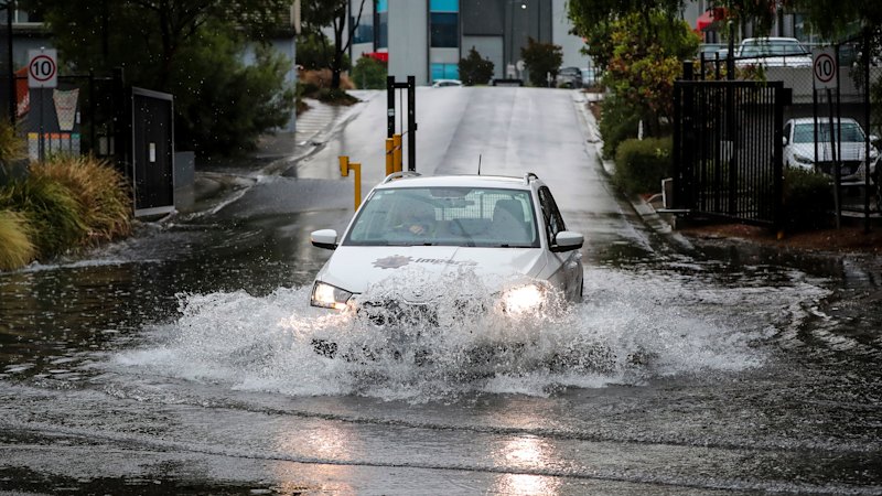
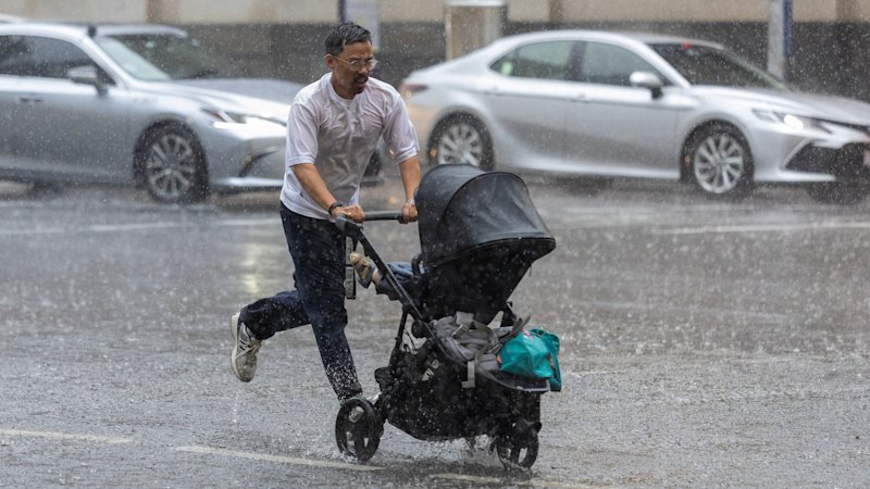
South-east Australia is experiencing severe weather conditions following one of its driest Septembers on record, with Melbourne receiving only 18mm of rainfall last month compared to a sudden downpour of 20mm in just an hour. The region faces continued heavy rain and potential flooding over the next few days as tropical moisture feeds into a low-pressure system. Thunderstorms are expected to become severe, posing risks of intense rainfall, damaging winds, and hail, particularly affecting northern and eastern Victoria, parts of New South Wales, Adelaide, Canberra, and Sydney.
Written by AI on 2026-10-01, from this article's own text only (the story summary below draws on all the coverage).

AI analysis

Story summary

Heavy rains began hitting southeastern Australia, particularly Victoria, starting on Thursday, September 26. The Bureau of Meteorology predicted that most areas in Victoria would receive 25-50mm of rain over several days, with some regions like Gippsland and the Otway Ranges expecting up to 150mm, equivalent to one to three months' worth of rainfall. Melbourne experienced its wettest day since April 2024, recording up to 50mm in a single day, causing flash flooding and trapping vehicles under bridges. The rain was part of a weather event following the second-driest September on record for many areas, with Melbourne receiving only 18mm last month but seeing 20mm fall within an hour on Thursday afternoon. Conditions are expected to worsen over the weekend, potentially leading to more flooding and severe thunderstorms in Gippsland and northeastern parts of Victoria, prompting warnings from emergency services not to drive through floodwaters.

Written for “Southeast Australia Floodingstorms” on 2026-11-02, grounded in this article and the 3 other(s) covering the same event.

Story

📰 Southeast Australia Floodingstorms
Environment · 4 article(s) covering the same event. Compare every outlet's account →

Compared with similar articles

This article reads unscored and hedges 42% of its claims. Each row says how that neighbour differs.
ABC News (AU)
Hedges 1 of 3 claims Outlet record 68/100
“The articles describe different time periods and weather conditions in south-east Queensland.”
The Sydney Morning Herald
Hedges 3 of 19 claims Outlet record 61/100
ABC News (AU)
Hedges 4 of 25 claims Outlet record 68/100
ABC News (AU)
Hedges 4 of 26 claims Outlet record 68/100
“The articles describe different regions (south-east Australia vs southern parts of Queensland) and slightly different time frames with distinct storm patterns.”
The Sydney Morning Herald
Hedges 1 of 13 claims Outlet record 61/100
“The first article describes initial heavy rains and potential flooding in south-east Australia, while the second covers record-breaking rainfalls across Victoria days later.”
The Sydney Morning Herald
Hedges 1 of 15 claims Outlet record 61/100
“The articles describe different time periods and focus on different regions experiencing rainfall after dry spells.”
How this article was measured signals, leaning charts, publisher record, byline, topics and claims

Signals How these are calculated →

Claims extracted
24
sentences that state something as happening or true
Uncertain
42%
10 of 24 hedged ("reportedly", "may", "according to")
Leaning
not political
takes no side on a contested political question
Publisher signals
68/100
ABC News (AU)'s corrections and hedging, across everything collected from it. Not a measure of accuracy.
Outlets on this story
4
Environment
Same framing elsewhere
1
articles that frame the event the way this one does
Analyzed 2026-10-01 · how these are computed

How this is being covered How these are calculated →

Article leaning vs. publisher reliability
Source leaning vs. consistency

Publisher

ABC News (AU) · 4628 article(s) · 10 correction(s) detected
Running correction rate · 10 correction(s)

Who wrote this

Tom Saunders
8 article(s) here · 1 carrying a prediction
🔮 And modelling shows our 2026/27 cyclone season, which runs from November 1 to April 30, could be one of the quietest on record.
🔮 This week, record rain and extreme flooding hit south-east Queensland and rain and storms will extend across more than half the country this weekend as two separate weather systems collide over the east.
🔮 If no echoes are returned, the radar imagery will stay blank.
🔮 October has been particularly damp thanks to an ongoing outbreak of showers and thunderstorms forecast to affect more than half the country during the next seven days.
🔮 A major rain and storm event intensifying across south-east Australia could trigger flooding during the next 48 hours.
🔮 Anthropic has warned investors that its technology could pose “existential risks to humanity” as it prepares to list on the sharemarket.
🔮 The hearing earlier this year focused on an arcane section of the watchdog’s rule book: whether Odey – who twice fired his executive committee before it could discipline him about allegations he “lacked integrity” – acted “recklessly” and breached its rules.
🔮 Following a polar blast this week, temperatures across south-east states will soar as much as 12 degrees Celsius above average this weekend.
Also by Tom Saunders
Nothing else under this byline is closely related to this article, so these are simply their most recent.
All 8 articles by Tom Saunders →

Topics

Adelaide Melbourne NSW Sydney Victoria

Subjects

Victoria GPE · 5× Adelaide GPE · 3× Gippsland GPE · 3× Melbourne GPE · 3× NSW GPE · 3× Sydney GPE · 3× Australia GPE · 2× Canberra GPE · 1× New South Wales GPE · 1× South Australia GPE · 1×

Narrative

But in such a large country there is always variability, and pockets of every state and territory did see September records fall, including Canberra, where temperatures landed at 2.35C above the city's long-term mean. Sydney, Perth, Adelaide and Hobart all had their second-warmest Septembers on record, but the most extraordinary anomalies were over the outback, where temperatures were as much as 5C above the long-term mean. Alpine Australia also experienced unprecedented early spring heat, including Thredbo, where temperatures were more than 1.5C warmer than the previous-warmest September. For south-east Australia, it was also the second-driest September, but again, there are pockets that did see record low falls, including around central SA, the Victoria coast and along the central stretch of the NSW ranges.
framing: mixed · carried by 1 article(s) · first seen 2026-10-01
🔮 A major rain and storm event intensifying across south-east Australia could trigger flooding during the next 48 hours.

Claims (24 extracted, 10 hedged)

A major rain and storm event intensifying across south-east Australia could trigger flooding during the next 48 hours. uncertain
event → intensify → hours
The sudden soaking follows a severe lack of rain in September — Melbourne only picked up 18mm last month, but was soaked by 20mm in just one hour on Thursday afternoon. And for many areas, even heavier rain is still to come as a stream of tropical moisture feeds into a low-pressure system over the southern Murray Basin. asserted
stream → follow → Basin
The system is notable for its slow movement, which should ensure moderate to heavy falls continue on Friday, with a focus across northern and eastern Victoria, along with the south-east corner of New South Wales. asserted
falls → ensure → Wales
Isolated thunderstorms are also firing up near the leading edge of the rainband, and with abundant moisture and an overriding jet stream, storms could become severe and produce intense rainfall, with a lesser risk of damaging winds and large hail. uncertain
storms → fire → winds
In the meantime, rain in South Australia has now mostly eased back to showers, although some coastal regions, including Adelaide, could still pick up another 10mm or more by Friday night. uncertain
regions → ease → night
While the main band of precipitation has been shifting slowly east, as the low drifts towards Bass Strait on Saturday, it could re-circulate rain back across southern Victoria. uncertain
it → shift → Victoria
It means moderate to possibly heavy falls and thunderstorms are still possible on Saturday across a large swathe of Victoria, along with central and eastern NSW. uncertain
falls → mean → NSW
By Sunday the low should be slowly retreating in the Tasman Sea, although a few showers and storms are still possible in Gippsland and south-east NSW. asserted
showers → retreat → Gippsland
Since this system is quite complex, let's go through the likely evolution of the weather during the coming days for our affected capitals: asserted
's → let → capitals
Adelaide – showers are likely through Friday morning and afternoon, but modelling indicates they should mostly clear to the east in the evening with only the odd shower returning Saturday. asserted
they → indicate → shower
The weather on Saturday depends on the exact location of the low, but the risk of heavy falls returning to Melbourne asserted
risk → depend → Melbourne
All up, this event could bring more than 50mm to the outer metropolitan region, while the inner suburbs and CBD could pick up from 20 to 50mm, including what fell on Thursday. uncertain
what → bring → Thursday
Rain is almost guaranteed both Friday and Saturday, including the risk of severe thunderstorms. asserted
Rain → guarantee → thunderstorms
Modelling is indicating 20 to 60mm during the next 36 hours, before rain mostly clears on Saturday night. asserted
rain → indicate → night
Sydney — rain should arrive later Friday from the west and could intensify on Saturday with possible thunderstorms. uncertain
rain → arrive → thunderstorms
While moderate falls are possible, modelling is favouring the heaviest rain will remain just to the west and south of Sydney. asserted
rain → favour → Sydney
Multiple catchments on Flood Watch All up, the weather system is likely to drop at least 25mm south of a line from about Adelaide to Sydney, including pockets near 100mm over southern and north-east Victoria. asserted
system → drop → Victoria
There are some indications parts of Gippsland could even see closer to 150mm, definitely enough to trigger river rises despite dry catchments after below-average rain through winter and September. uncertain
parts → be → winter
As a result, a Flood Watch is in force for minor to moderate flooding across 16 separate catchment regions covering Gippsland, North East and Central Victoria. asserted
Watch → cover → Gippsland
The moist tropical airstream is also producing a secondary area of rain across the western interior near another trough of low pressure. asserted
airstream → produce → pressure
This outback rain could amount to 50mm, which is extremely unseasonable considering the WA interior averages only about 10 to 20mm through the entire month. uncertain
interior → amount → month
Rapid turnaround after hot, dry September Australia just experienced its second-warmest September on record, with the majority of the nation at least 2 degrees Celsius warmer than normal. asserted
majority → experience → nation
But in such a large country there is always variability, and pockets of every state and territory did see September records fall, including Canberra, where temperatures landed at 2.35C above the city's long-term mean. Sydney, Perth, Adelaide and Hobart all had their second-warmest Septembers on record, but the most extraordinary anomalies were over the outback, where temperatures were as much as 5C above the long-term mean. Alpine Australia also experienced unprecedented early spring heat, including Thredbo, where temperatures were more than 1.5C warmer than the previous-warmest September. For south-east Australia, it was also the second-driest September, but again, there are pockets that did see record low falls, including around central SA, the Victoria coast and along the central stretch of the NSW ranges. asserted
that → be → ranges
But the wet start to October could be a sign of wetter months ahead, with modelling tipping further rain during the coming weeks, along with a general improvement in rain prospects as we transition into summer. uncertain
we → tip → summer

💬Give feedback
🕘History 🎫Support